Revolutionizing Geological Mapping: Specialized Training in Remote Sensing Imagery for Nigerian Mining Sector
In an effort to establish Nigeria as a premier destination for mining investments, technical staff members from the Ministry of Solid Minerals Development, Solid Minerals Development Fund, Council of Nigerian Mining Engineers and Geoscientists (COMEG) recently participated in a one-day workshop on remote sensing imagery. The workshop, which was held in Abuja and organized by the SMDF, aimed to provide participants with the necessary skills to enable more precise and cost-effective collection of geoscience data.
The training workshop was led by renowned image processing specialist Neil Pendock, who boasts over 40 years of experience in remote sensing practice. This initiative reflects a commitment to substantial investment in big data for the purpose of reducing risk in investments and attracting more entrepreneurs to the mining industry, sentiments which were echoed by the Minister of Solid Mineral Development, Dr. Oladele Alake.
Pendock emphasized the potential for cost savings offered by Remote Sensing Imagery (RSI) technology, which has been effectively utilized by leading mining nations such as Australia, Canada, and South Africa. He stressed that the application of RSI technology would yield high-quality geoscience data, positioning Nigeria as a global mining investment hub. Furthermore, he highlighted that RSI technology would not only reduce exploration costs, but also significantly decrease exploration time when compared to traditional methods.
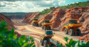
The workshop also addressed the potential for Remote Sensing Imagery to combat Nigeria’s illegal mining challenges, as it has the capability to remotely capture activity images via satellite. Pendock expressed optimism that with better organization and transparency in data management, Nigeria’s extensive mineral resources could enable the nation to compete favorably with other mineral-rich countries.
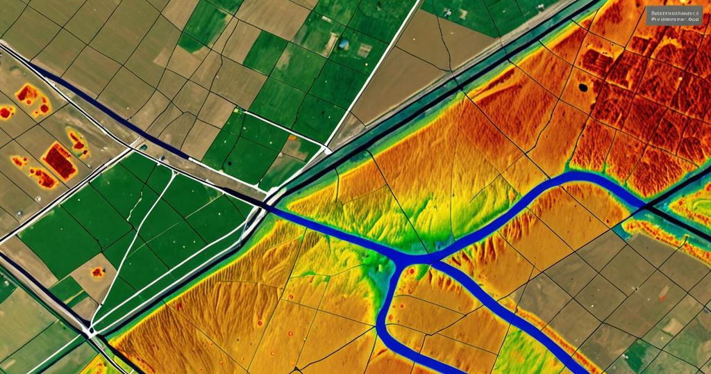
In addition to encouraging the Nigerian government to promote environmentally friendly mining, Pendock underscored the significance of thermal data in geological mapping. This technology enables the identification of mineral deposits concealed underground or beneath vegetation, even during nighttime, when rocks cool down and release thermal energy.
Idowu Jokpeyibo, head of corporate communications at SMDF, emphasized that the workshop served as a follow-up to a Memorandum of Understanding (MoU) signed by the SMDF with GeoScan GmbH of Berlin, Germany, with the aim of advancing the exploration and development of Nigerian critical minerals using innovative proprietary technology.
According to Jokpeyibo, the advanced Remote Sensing Imagery technology deployed by GeoScan GmbH is capable of exploring mineral deposits up to 10,000 meters below the surface, and is significantly more cost-effective and faster than current exploration processes.
Kefas Malgwi, Head of the Mineral Exploration Department at SMDF, reiterated the workshop’s significance in enhancing the technical understanding of exploration targets and improving the quality of geological data collection and analysis in the country’s solid minerals sector. This training aligns with the government’s efforts to build capacity in the use of remote sensing technology, thereby strategically positioning Nigeria’s data generation system and addressing industry challenges.
In conclusion, the adoption of Remote Sensing Imagery technology in the Nigerian mining sector represents a substantial step towards revolutionizing geological mapping and enhancing the nation’s mineral exploration capabilities. Through targeted training initiatives and strategic partnerships, Nigeria is poised to attract increased investments and emerge as a formidable player in the global mining industry.